Tsunami warning issued to northern California after massive off-shore quake
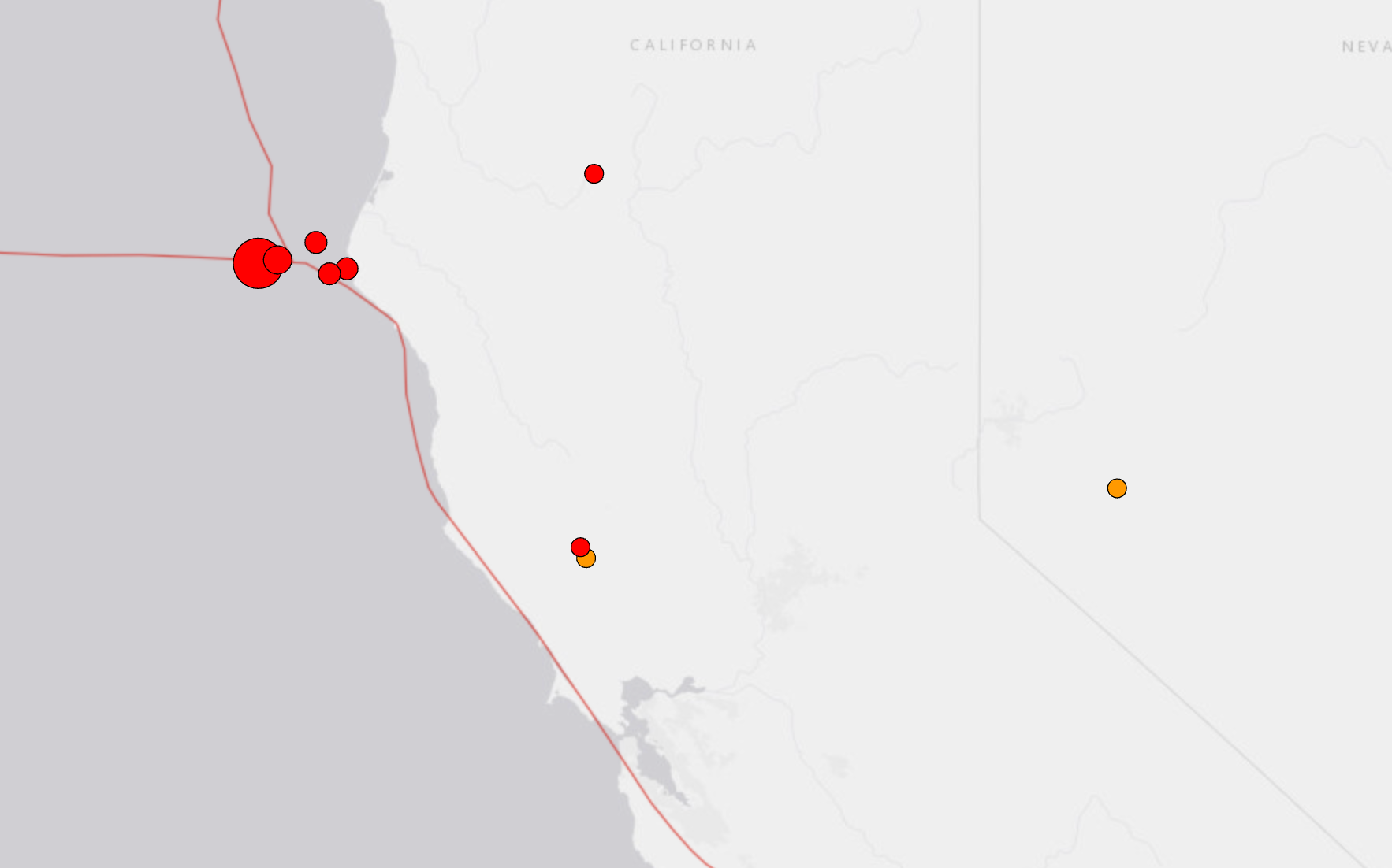
The United States Geological Survey is showing a 7.0 earthquake off the cost of northern California that was severe enough for residents nearby to get a notification of a tsunami warning.
Yahoo News cited a National Weather Service social media post, which marked the quake at 7.3 on the Richter Scale.
At approximately 1:44 p.m. EST, the quake rumbled about 40 miles off the coast of Petrolia, CA, leading the state to issue tsunami warnings to those down the west coast.
However, it wasn't merely the 7.0 quake that was cause for concern. MSNBC reported that the quake happened along with several others, which are also indicated on the USGS quake map. They are all in the same area and range in severity form 3.3 to 4.2 on the Richter Scale.
ALSO READ: 'You are out of line!': Secret Service chief screams at GOP lawmaker for politicizing 9/11
Meanwhile, other quakes seem to be popping up on the land in northern California, such as a 2.5 quake 16 km from French Gulch, CA. A separate 2.5 also popped up on the map about 6 km northwest of Cobb, California.
“The National Weather Service has issued a TSUNAMI WARNING. A series of powerful waves and strong currents may impact coasts near you,” the alert read in the San Francisco Bay Area. “You are in danger. Get away from coastal waters. Move to high ground or inland now. Keep away from the coast until local officials say it is safe to return.”
One Bay Area resident said on X it was the first time he's ever gotten a tsunami warning.