


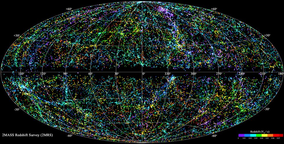
British astronomers announced Wednesday they had completed the largest-ever map of the local universe using a type of lens and filter that sees light differently than conventional telescopes.
Researchers at the University of Portsmouth called the image, formally titled the 2MASS Redshift Survey, one of their greatest accomplishments yet, noting that it took over 10 years to create.
The map shows every visible star, planet and neighboring galaxy extending out for 380 million light years, astronomers said.
The survey was completed with the help of space observatories in Arizona and Chile that scanned the sky for near-infrared light, which is easier to detect through cosmic dust clouds.
The full 2MASS Redshift Survey appears below.
To see a higher-quality version, click here.
(H/T: Space.com)
Image credit: Flickr commons.
Editor's note: This article has been corrected to state the true size of the map. An earlier version erroneously said it showed 450 light years.
