




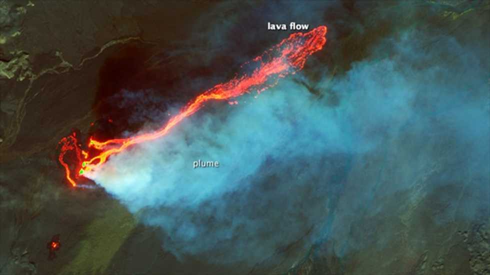
NASA satellite images have captured images of a singularly big volcanic eruption in Iceland, Vox reported.
Researchers estimate that the Bárðarbunga volcanic system's eruption is the country's biggest since the 19th century, with lava exploding from the ground as high as 165 feet, producing a 10-mile flow. The University of Iceland estimated that the lava had covered 8 square miles since erupting on Aug. 31.
"High resolution imagery of this kind allows us to model the dynamics of the emplacement process," NASA volcano sensor lab head Ashley Davies was quoted as saying. "In this case, individual vents can be seen feeding separate lava flows that combine into a main channel feeding an expanding lava flow field."
Satellite imagery of the eruptions near Bárðarbunga, as posted by NASA, can be seen below.
The University of Iceland has also been posting pictures of the eruption on its Twitter page, including one shot of "twisters" forming in the area:
And Icelandic Air also posted a picture of the eruption as seen from a flight over the area, as seen here:
